Geoscientific decision intelligence

From territory to strategic decision.

Surface science over Brazil's official databases — with the method published, validation run under spatial blocking and temporal cut-off, and each engine's limits written into the result itself.

9.617.897
Mining registry events, from 1934 to today
ANM · SCM
970.723
Mining claims with full life cycle
ANM · SCM
28.992
Dams in the cross-checked federal registry
SIGBM · SNISB
17
Active scientific engines, on land, sea and coast
ORBIS·TERRA
102
References with DOI verified one by one
172 no total
A joint venture of Solit S.A. and Grupo Inepar
Grupo Inepar Solit S.A.

The frontiers

One scientific engine for each mineral frontier.

Each engine declares what it computes, by which method, over which data — and what it cannot see. Three frontiers carry the industrial mission: gold, oil and gas, and strategic mineral commodities.

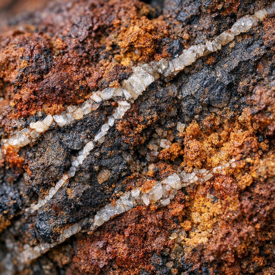
Afloramento de gossan: capa de óxido de ferro sobre veio sulfetado, com veios de quartzo
Gold

Prospectivity through hydrothermal alteration

Twelve weighted layers — iron oxides, hydroxyls, gossan, SAR texture, structural density, thermal residual — composed into four deposit models: orogenic, epithermal, porphyry/IOCG and placer.

  • Spectral ratios with cited origin: Sabins (1999) ferric index, lineaments after Madrucci and colleagues (2003).
  • Real Monte Carlo resource estimation: 1,500 realisations with a fixed seed. The P90/P10 ratio fell from 1,652× to 7.3× once the closed formula was replaced by sampling — the first number measured the formula, not the uncertainty.
  • Six models, none supervised: what the engine calls learning is multivariate anomaly detection. It says so in the report.
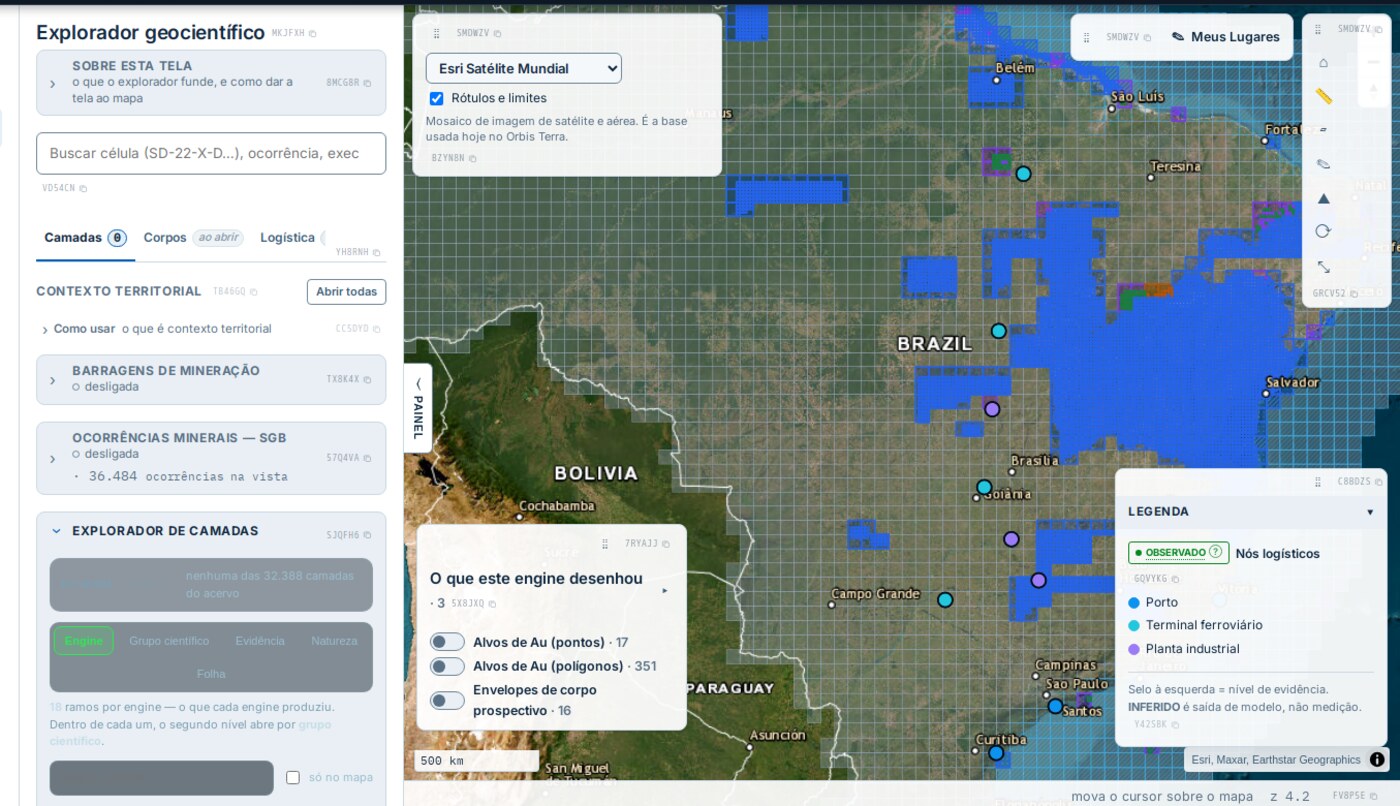
Explorador geocientífico com alvos de ouro sobre o território brasileiro
Au targets as points and polygons, prospective body envelopes, and SGB mineral occurrences in the same stack.
Quebra da plataforma continental com plumas de sedimento, vista de alta altitude
Oil and gas

Microseepage onshore, surface film offshore

Onshore, nine evidence layers with directed PCA (the Crósta technique) over surface alteration. Offshore, recurrent surface film detected by calibrated SAR.

  • 31,293 drilled wells ingested from ANP, plus 418 blocks, 428 fields and 72 basins.
  • What the engine declares it cannot see: no evidence is from the subsurface. Seal does not exist as a layer, and “depth” is a spatial filter scale, not a geological measurement.
  • Barrels are not recoverable volume: the report itself warns that reading them that way is the costliest error it allows.
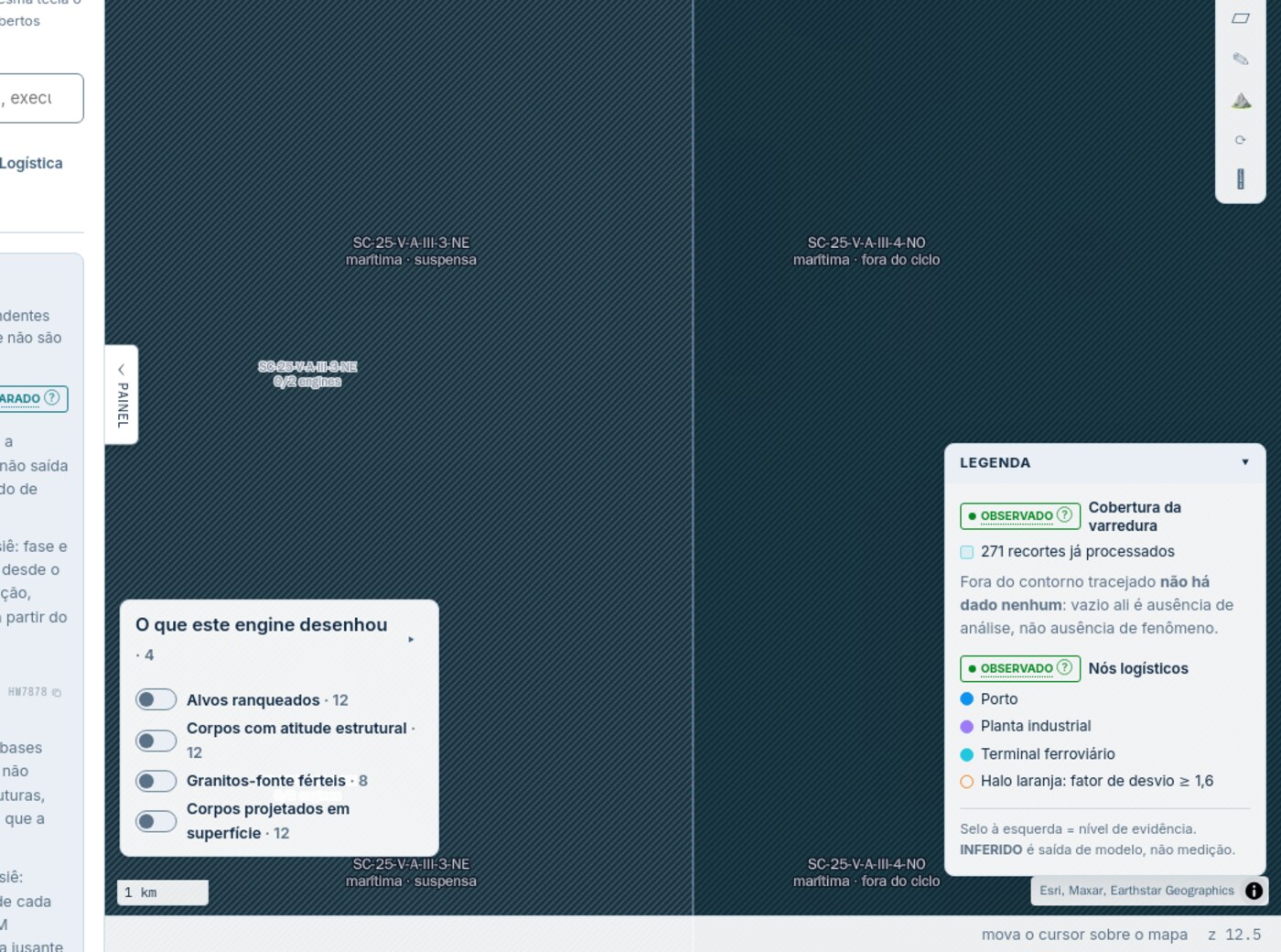
Grade de varredura marítima sobre a plataforma continental
Survey grid over the continental shelf, with already-processed coverage declared cell by cell.
Espécime de pegmatito zonado com cristais de espodumênio e quartzo fumê
Strategic minerals

Pegmatites, rare earths and niobium

Favourability of LCT systems with zoning, plus carbonatite and ionic clay for rare earths and niobium. The official list is CTAPME Resolution No. 2/2021 — 24 commodities in three groups.

  • Back-test published even when unfavourable: across 20 paired runs in the Borborema Province the target score saturated at 1.000 and AUC came out at 0.500. It is on the engine's own page.
  • What did separate: the share of the area with favourability above 0.66 — AUC 0.940 and a +0.825 correlation with lithium mining claims filed nearby.
  • Declared physical limit: lithium, beryllium, tantalum and tin produce no absorption feature in the infrared in use. No optical sensor detects them directly — and the platform does not pretend otherwise.
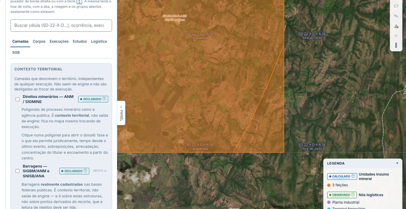
Camada de engine acesa sobre o território
Engine layer over the territory, with the evidence level declared: calculated is model output, not measurement.

The method

Validation is published alongside the number that undercuts it.

Almost every organisation publishes the validation that flatters the model. Here the three numbers appear together: the result, the base rate it must beat, and how much conventional validation was inflating. Measured over 267,019 mining claims.

Model Random split Spatial blocking Temporal cut-off
Base rate (commodity × decade)0,85040,84510,7150
Claim age alone0,63590,63640,5820
Logistic regression0,88800,88360,8673
Gradient boosting0,93810,92160,8917

Spatial blocking trains on some regions and tests on others, answering whether the model works where it never looked. Temporal cut-off trains on the past and tests on the future. The gap against the random column — +0.017 and +0.046 — is leakage, not performance. And the ablation shows the gain does not come from claim age, which alone sits at 0.64.

Declared science per engine

Nineteen modules written from reading the code itself, each with its caveat and list of limitations — including when the result condemns the engine.

Citations checked, not requested

The copilot strips any marker pointing to a source that does not exist. No source, no answer — and the refusal names which of three causes produced it.

Cells composable bit for bit

A one-third arc-second lattice and reprojection exact to 1e-6 of a pixel: three engines write the same extent without a single differing value.

The limits

What ORBIS·TERRA is not.

The platform that overstates what it delivers is the one that loses the trust of whoever decides. These limits travel with every result, inside the report and the table.

Not a substitute for reserve certificationJORC, NI 43-101 and the CBRR Guide require a Competent Person. What comes out of here is reconnaissance and triage.
Not a substitute for field or laboratoryNo result removes the need for field validation, laboratory analysis or an engineering report.
Absence of signal is not stabilityFor dams, satellite revisit is about twelve days. Failures happen in minutes. The platform says so rather than staying silent.
Coverage is not nationalSGB occurrences are ingested for part of the territory. Only the dam registry is national today.

The sources

Official databases, collected through the front door.

Twenty-five catalogued sources with a mandatory collection order: official interface before public download, public download before manual delivery. When a source does not respond, that is recorded as a fact, not an omission.

ANM · SIGMINE · SIGBM SGB · Serviço Geológico do Brasil ANA · SNISB ANP · poços, blocos, campos EPE · sistema interligado Embrapa · solos IBGE · malha territorial Sentinel-1 / 2 · Copernicus Landsat · USGS CBERS-4A · INPE
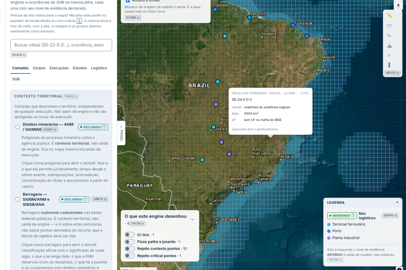
Fusão multinível no explorador geocientífico
Multi-level fusion: base cartography, engine evidence and official registry, each layer with its declared evidence level.

The Earth, indexed for decision.

Institutional access for public bodies, regulators and operators in the mineral-industrial sector.